

Hurricane tracker: Follow Helene's path on this interactive map
Hurricane Helene made landfall late Thursday as a Category 4 hurricane and reached sustained winds of 220 km/h in the Big Bend region of Florida.
Since then, Helene has weakened to a Category 1 hurricane in intensity as of Friday afternoon, but it did considerable damage – including bringing “significant flooding” to Florida’s Clearwater coast, according to the city’s mayor, Bruce Rector.
Meanwhile, six states are under states of emergency and storm watches and warnings are in place for about 60 million people in 12 states, as Helene continues to batter the southeastern U.S. with heavy winds and torrential rain.
Below is a live hurricane tracker on Esri’s ArcGIS mapping platform, using live data from the NOAA National Hurricane Center (NHC) tracking Helene’s observed and forecasted paths.
Shopping Trends
The Shopping Trends team is independent of the journalists at CTV News. We may earn a commission when you use our links to shop. Read about us.


CTVNews.ca Top Stories

King Charles III focuses Christmas message on healthcare workers in year marked by royal illnesses
King Charles III used his annual Christmas message Wednesday to hail the selflessness of those who have cared for him and the Princess of Wales this year, after both were diagnosed with cancer.
Azerbaijani airliner crashes in Kazakhstan, killing 38 with 29 survivors, officials say
An Azerbaijani airliner with 67 people onboard crashed Wednesday near the Kazakhstani city of Aktau, killing 38 people and leaving 29 survivors, a Kazakh official said.
Second storm incoming for Christmas Day in southern B.C.
Environment Canada has issued a new series of weather warnings for British Columbia’s south coast Christmas morning.
What is Christmas like for Quebec health-care workers who stay on the job?
Most Quebecers get together with family and friends on Christmas Eve, but many professions require people to remain on the job at all times, including health-care workers.
Montreal man dead after boat explodes in Fort Lauderdale
A Montreal man is dead and several others are injured after a boat exploded in Fort Lauderdale, Florida.
Mother-daughter duo pursuing university dreams at the same time
For one University of Windsor student, what is typically a chance to gain independence from her parents has become a chance to spend more time with her biggest cheerleader — her mom.
Trial of man accused in Trump assassination attempt in Florida pushed back to September
A man accused of attempting to assassinate President-elect Donald Trump in South Florida won't be tried until September 2025, a federal judge ruled this week.
Pope urges 'all people of all nations' to silence arms and overcome divisions in Christmas address
Pope Francis in his traditional Christmas message on Wednesday urged 'all people of all nations' to find courage during this Holy Year 'to silence the sounds of arms and overcome divisions' plaguing the world, from the Middle East to Ukraine, Africa to Asia.
Read Trudeau's Christmas message
Prime Minister Justin Trudeau issued his Christmas message on Tuesday. Here is his message in full.
Canada
-

Montreal man dead after boat explodes in Fort Lauderdale
A Montreal man is dead and several others are injured after a boat exploded in Fort Lauderdale, Florida.
-

Indigenous family faced discrimination in North Bay, Ont., when they were kicked off transit bus
Ontario's Human Rights Tribunal has awarded members of an Indigenous family in North Bay $15,000 each after it ruled they were victims of discrimination.
-
Norad crew waiting for Santa to fly over Canada as annual holiday track underway
Departing from the North Pole while we were all sleeping, Santa Claus' journey around the world bringing presents and Christmas cheer for all of the good boys and girls who believe is underway.
-
How Christmas shopping could help support adults with development disabilities
Members of Adults in Motion have been busy making keychains, cards and more for the holidays.
-
Ontario First Nation challenging selection of underground nuclear waste site in court
A First Nation in northern Ontario is challenging the selection of a nearby region as the site of a deep geological repository that will hold Canada's nuclear waste, arguing in a court filing that it should have had a say in the matter as the site falls "squarely" within its territory.
-
OPP and Ottawa firefighters help remove vehicle wedged into Highway 417 overpass
Ottawa firefighters and local Ontario Provincial Police officers were called to a bizarre scene Tuesday morning along Highway 417, where a driver managed to wedge his vehicle under an overpass.
World
-

Azerbaijani airliner crashes in Kazakhstan, killing 38 with 29 survivors, officials say
An Azerbaijani airliner with 67 people onboard crashed Wednesday near the Kazakhstani city of Aktau, killing 38 people and leaving 29 survivors, a Kazakh official said.
-
King Charles III focuses Christmas message on healthcare workers in year marked by royal illnesses
King Charles III used his annual Christmas message Wednesday to hail the selflessness of those who have cared for him and the Princess of Wales this year, after both were diagnosed with cancer.
-
Pope urges 'all people of all nations' to silence arms and overcome divisions in Christmas address
Pope Francis in his traditional Christmas message on Wednesday urged 'all people of all nations' to find courage during this Holy Year 'to silence the sounds of arms and overcome divisions' plaguing the world, from the Middle East to Ukraine, Africa to Asia.
-
Trial of man accused in Trump assassination attempt in Florida pushed back to September
A man accused of attempting to assassinate President-elect Donald Trump in South Florida won't be tried until September 2025, a federal judge ruled this week.
-
Syria's new foreign minister tells Iran not to spread chaos in Syria
Syria's newly appointed foreign minister, Asaad Hassan al-Shibani, told Iran on Tuesday not to spread chaos in Syria but to respect the Syrian people's will and the country's sovereignty.
-
On Christmas Eve, Pope Francis appeals for courage to better the world
Pope Francis said the story of Jesus' birth as a poor carpenter's son should instill hope that all people can make an impact on the world, as the pontiff on Tuesday led the world's Roman Catholics into Christmas.
Politics
-

Canada condemns China's steps against Canadian institutions over Uyghurs, Tibet
The Canadian government condemned China on Tuesday for taking steps against two Canadian institutions and 20 people involved in human rights issues concerning the Uyghurs and Tibet.
-
Trudeau could stay or go. Either way, Canadians should brace for a spring election
Canada appears to be barrelling toward a spring election now that the NDP is vowing to vote down the government early next year -- whether Prime Minister Justin Trudeau stays on or not.
-
What is flagpoling? A new ban on the practice is starting to take effect
Immigration measures announced as part of Canada's border response to president-elect Donald Trump's 25 per cent tariff threat are starting to be implemented, beginning with a ban on what's known as 'flagpoling.'
Health
-

How much is too much alcohol over the holidays? A doctor explains
The holidays are here, as are the parties, happy hours and other get-togethers that often offer abundant mixed drinks, beer and wine.
-
Oysters distributed in B.C., Alberta, Ontario recalled for norovirus contamination
The Canadian Food Inspection Agency has issued a recall due to possible norovirus contamination of certain oysters distributed in British Columbia, Alberta and Ontario.
-
Back on air: John Vennavally-Rao on reclaiming his career while living with cancer
'In February, there was a time when I thought my career as a TV reporter was over,' CTV News reporter and anchor John Vennavally-Rao writes.
Sci-Tech
-

Young mammoth remains found nearly intact in Siberian permafrost
Researchers in Siberia are conducting tests on a juvenile mammoth whose remarkably well-preserved remains were discovered in thawing permafrost after more than 50,000 years.
-
Multiple OnlyFans accounts featured suspected child sex abuse, investigator reports
An experienced child exploitation investigator told Reuters he reported 26 accounts on the popular adults-only website OnlyFans to authorities, saying they appeared to contain sexual content featuring underage teen girls.
-
Dutch discover rare 500-year old wooden shoe
The Dutch are known worldwide for their wooden shoes, but the recent rare discovery of a 500-year-old one in the city of Alkmaar has shown just how widespread their use once was.
Entertainment
-

Justin Baldoni's 'Man Enough' podcast co-host Liz Plank announces her departure
Justin Baldoni's 'Man Enough' podcast co-host Liz Plank announced she's stepping away from the show after actress Blake Lively accused the actor and director of sexual harassment and a smear campaign in a civil rights complaint last week.
-
'I became fluent in Bob': How the costume designer of 'A Complete Unknown' transformed Timothee Chalamet
If fashion is a language, Arianne Phillips, costume designer on James Mangold's latest film 'A Complete Unknown,' is a polyglot.
-
Christopher Nolan's next film is based on 'The Odyssey'
Christopher Nolan is following his Oscar-winning "Oppenheimer" with a true epic: Homer's "The Odyssey." It will open in theaters on July 17, 2026, Universal Pictures said Monday.
Business
-

Heavy travel day starts with brief grounding of all American Airlines flights
American Airlines briefly grounded flights nationwide Tuesday because of a technical problem just as the Christmas travel season kicked into overdrive and winter weather threatened more potential problems for those planning to fly or drive.
-
Starbucks strike to expand to over 300 U.S. stores on Christmas Eve, union says
A strike at Starbucks will expand to over 300 U.S. stores on Tuesday, with more than 5,000 workers expected to walk off the job before the five-day work stoppage ends later on Christmas Eve, the workers' union said.
-
Toyota is donating US$1 million to Trump's inauguration
Toyota Motor of North America is donating US$1 million to U.S. president-elect Donald Trump's Jan. 20 inauguration, a company spokesman said on Tuesday, a day after Detroit's Ford Motor and General Motors, said they would give the same amount.
Lifestyle
-

The Santa Awards: Ranking the best (and most ridiculous) Father Christmases ever to grace our screens
Behold, for your festive perusal, some of the most beloved, cherished and out-there onscreen renditions of dear old Saint Nick.
-
Why couples in Japan treat Christmas like a second Valentine's Day
One of Sumire Sekino’s most memorable Christmases involved spending the day hopping around some of Tokyo’s best date spots with her boyfriend.
-
B.C. friends nab 'unbelievable' $1M lotto win just before Christmas
Two friends from B.C's lower mainland are feeling particularly merry this December, after a single lottery ticket purchased from a small kiosk landed them instant millionaire status.
Sports
-

Panthers' Hubbard among NFL's elite running backs as he joins exclusive Canadian club
Chuba Hubbard has reached 1,000 yards rushing this NFL campaign, joining a handful of others near the top of the league stats sheet, but also to become just the second Canadian to reach the mark in a season.
-
Ottawa welcomes new Team Canada fans with citizenship ceremony ahead of the World Juniors
Ottawa is welcoming the world as it hosts the IIHF World Junior Hockey Championship. But first, some new Team Canada fans were sworn in at a citizenship ceremony at the Canadian Tire Centre on Monday.
-
Packers clinch playoff berth with 1st shutout in NFL this season, 34-0 over Saints
With a dominant defence leading the way, the Green Bay Packers clinched a playoff berth by producing their most lopsided win in a decade.
Autos
-

More drivers opt for personalized plates in Sask. — and behind every one there's a story
You may have noticed a few more vanity plates on Saskatchewan roads in recent years, and every one of them comes with a personal story.
-
Nissan and Honda to attempt a merger that would create the world's No. 3 automaker
Japanese automakers Honda and Nissan have announced plans to work toward a merger that would form the world's third-largest automaker by sales, as the industry undergoes dramatic changes in its transition away from fossil fuels.
-
Ford Motor donates US$1 million and fleet of vehicles to Trump's inauguration
Ford Motor Co F.N is donating US$1 million and a fleet of vehicles to U.S. president-elect Donald Trump's January inauguration, a company spokesperson said on Monday.
Local Spotlight

B.C. friends nab 'unbelievable' $1M lotto win just before Christmas
Two friends from B.C's lower mainland are feeling particularly merry this December, after a single lottery ticket purchased from a small kiosk landed them instant millionaire status.
'Can I taste it?': Rare $55,000 bottle of spirits for sale in Moncton, N.B.
A rare bottle of Scotch whisky is for sale in downtown Moncton, N.B., with a price tag reading $55,000.
No need to dream, White Christmas all but assured in the Maritimes
An early nor'easter followed by a low-pressure system moving into the region all but ensure a Maritime White Christmas
'I'm still thinking pinch me': lost puppy reunited with family after five years
After almost five years of searching and never giving up hope, the Tuffin family received the best Christmas gift they could have hoped for: being reunited with their long-lost puppy.
Big splash: Halifax mermaid waves goodbye after 16 years
Halifax's Raina the Mermaid is closing her business after 16 years in the Maritimes.
Willistead Manor celebrates the Christmas season in style, with only two weekends left to visit
From the Great Hall to the staircase and landings, to the conservatory – hundreds of people have toured the Willistead Manor this December.
Music maker, 88, creates unique horn section, with moose antler bass guitar and cello
Eighty-eight-year-old Lorne Collie has been making musical instruments for more than three decades, creations that dazzle for their unique materials as much as their sound.
Promise of high-level hockey comes at a cost for prep school players at Circle K Classic
Calgary is set to host the Circle K Classic, welcoming some high-end talent and pricey prep schools for the annual U18 AAA hockey tournament.
School custodian stages surprise for Kitchener, Ont. students ahead of holiday break
He’s no Elf on the Shelf, but maybe closer to Ward of the Board.
Vancouver
-
King Charles III focuses Christmas message on healthcare workers in year marked by royal illnesses
King Charles III used his annual Christmas message Wednesday to hail the selflessness of those who have cared for him and the Princess of Wales this year, after both were diagnosed with cancer.
-
Second storm incoming for Christmas Day in southern B.C.
Environment Canada has issued a new series of weather warnings for British Columbia’s south coast Christmas morning.
-
Read Trudeau's Christmas message
Prime Minister Justin Trudeau issued his Christmas message on Tuesday. Here is his message in full.
Toronto
-

Man dead, woman in hospital after overnight housefire in Scarborough
An elderly man has died after being pulled from a two-alarm house fire in Scarborough Christmas morning.
-
Woman rushed to hospital after being pulled from Davisville apartment fire
An elderly woman was rushed to hospital with life-threatening injuries after being pulled from an apartment fire in the Davisville Village area Christmas Eve.
-
'A strong woman who never gave up': East Toronto neighbourhood shaken by death of unhoused resident
People in Toronto’s east end are shaken after a well-known unhoused woman from the community reportedly died over the weekend.
Calgary
-

Speed, alcohol possible factors in Glenmore Trail crash that left man, 18, dead: police
Speed and alcohol are possible factors in a fatal crash on Glenmore Trail on Monday night, according to police.
-
Alberta premier hopes for health reform payoff in 2025, regrets deferring tax cut
"It may have been better for Albertans if we'd implemented and then found a way to be able to pay for it."
-
Azerbaijani airliner crashes in Kazakhstan, killing 38 with 29 survivors, officials say
An Azerbaijani airliner with 67 people onboard crashed Wednesday near the Kazakhstani city of Aktau, killing 38 people and leaving 29 survivors, a Kazakh official said.
Ottawa
-

Things to do in Ottawa on Christmas Day
CTVNewsOttawa.ca looks at things to do in Ottawa on Christmas Day.
-
Firefighters contain fire to basement before it could spread in Vanier
Ottawa Fire Services says a fire that started in a chair in the basement of a duplex in Vanier this Christmas morning was quickly stopped before spreading into the entire structure.
-
YEAR-IN-REVIEW
YEAR-IN-REVIEW Top stories in Ottawa in 2024
It was a year of change in Ottawa in 2024, with federal public servants required to spend more time in the office, alcohol now available in grocery stores and gas stations, and the Ottawa Senators taking the next step towards moving downtown.
Montreal
-
Montreal man dead after boat explodes in Fort Lauderdale
A Montreal man is dead and several others are injured after a boat exploded in Fort Lauderdale, Florida.
-
Premier François Legault sends holiday greetings to Quebecers
Quebec Premier François Legault extended his holiday greetings to Quebecers on Tuesday evening, on the occasion of Christmas Eve.
-
What is Christmas like for Quebec health-care workers who stay on the job?
Most Quebecers get together with family and friends on Christmas Eve, but many professions require people to remain on the job at all times, including health-care workers.
Edmonton
-
Alberta premier hopes for health reform payoff in 2025, regrets deferring tax cut
"It may have been better for Albertans if we'd implemented and then found a way to be able to pay for it."
-
Edmonton apartment building boarded up after evacuation order from the city
An Edmonton apartment building that was evacuated for safety reasons on Monday now sits boarded up.
-
Azerbaijani airliner crashes in Kazakhstan, killing 38 with 29 survivors, officials say
An Azerbaijani airliner with 67 people onboard crashed Wednesday near the Kazakhstani city of Aktau, killing 38 people and leaving 29 survivors, a Kazakh official said.
Atlantic
-

Two deaths in Truro ruled homicides: RCMP
Police in Nova Scotia are investigating after two deaths in Truro, N.S., over the weekend have been ruled homicides.
-
Snow forecast through Christmas Eve for parts of the Maritimes
Parts of the Maritimes that were hit by a weekend snowstorm are in for more of the white stuff this Christmas Eve.
-
'Can I taste it?': Rare $55,000 bottle of spirits for sale in Moncton, N.B.
A rare bottle of Scotch whisky is for sale in downtown Moncton, N.B., with a price tag reading $55,000.
Winnipeg
-

'They gambled with trees': Cutting down trees resumes in Lemay Forest
The next chapter of the Lemay Forest saga has unfolded as the sounds of trees coming down could be heard Monday.
-
One person dead, another injured following Monday night house fire
One person has died and another is in unstable condition following a house fire Monday evening.
-
Winnipeg police investigating string of packages being stolen
The Winnipeg Police Service is investigating a string of package thefts in the Transcona area.
Regina
-

Here's what's open and what's closed in Regina this holiday season
Here's what residents can expect in terms of city services as Regina slides right into the Christmas holidays.
-
This miniature village is a Christmas tradition for one Regina family
A miniature Christmas village made of decorative houses and buildings has been slowly growing in a Regina home.
-
Here are the most borrowed books of 2024, according to Regina Public Library
The Regina Public Library (RPL) has shared its most popular books just in time for the new year.
Kitchener
-

Feel-good stories of 2024: Dramatic dog rescue, Guelph toddler gets transplant and lost letters returned
Before we say goodbye to 2024, let’s look back at some of the good news stories we brought to you this year.
-
Why holiday shopping may feel a little different this year
At around 11 a.m. Tuesday at Kitchener’s Fairview Park Mall, there were plenty of parking spots available. It’s a sign that maybe this year, the rush for last minute gifts is no more.
-
How to stay safe during the holiday season
As fun festivities begin, the Canadian government, SickKids and fire departments in the Waterloo Region are reminding families of the higher safety risks during the holiday season.
Saskatoon
-

'People prop the doors open': Saskatoon resident concerned as people shelter in her stairwell
With the number of homeless people in Saskatoon at an unprecedented high, it’s no surprise people are looking for places to warm up.
-
Sask. highway closed following serious collision
The Saskatchewan RCMP are investigating a serious collision on Highway 7, approximately 15 kilometres west of Rosetown.
-
A separate Ukrainian Christmas may be a thing of the past
There might be more households than usual celebrating this Christmas Eve, as many Ukrainians around the world are opting to abandon the orthodox calendar.
Northern Ontario
-
Indigenous family faced discrimination in North Bay, Ont., when they were kicked off transit bus
Ontario's Human Rights Tribunal has awarded members of an Indigenous family in North Bay $15,000 each after it ruled they were victims of discrimination.
-
Quebec suspect charged with stunt driving in northern Ont.
A 25-year-old from Notre Dame du Nord, Que., has been charged with stunt driving, police in Temiskaming said Tuesday.
-
Dismiss Trump taunts, expert says after 'churlish' social media posts about Canada
U.S. president-elect Donald Trump and those in his corner continue to send out strong messages about Canada.
London
-

Palace Theatre boarded up over the holidays due to recent damage
A break in, theft, and continued property damage has led to the boarding up of the Palace Theatre over the Christmas holidays.
-
Knights stars ready to help Canada chase gold at World Juniors
Three London Knights are on the roster, including Easton Cowan, who scored a hat-trick in Canada’s first exhibition game.
-
London fire responds to Wellington Road collision, contains fuel leak
London Fire Department was on the scene of a two vehicle collision involving a delivery truck on Tuesday morning.
Barrie
-

Here's when Santa is coming down your chimney, live tracking underway in Simcoe County
The spirit of Christmas is in the air as Santa Claus begins his lasting journey to deliver presents to children around the region.
-
Help this missing pup make it home for Christmas
The Ontario SPCA in Barrie needs your help bringing this handsome pup home to his family before Christmas.
-
Last minute shoppers braced for chaos but found calm on Christmas Eve
Many shoppers were out on Christmas Eve, and while the rush was expected to be chaotic, many found the day surprisingly manageable.
Windsor
-

Mother-daughter duo pursuing university dreams at the same time
For one University of Windsor student, what is typically a chance to gain independence from her parents has become a chance to spend more time with her biggest cheerleader — her mom.
-
VIDEO
VIDEO From a repaired stuffed animal to an ATV, shoppers reveal the best gift they have ever received
We asked people of all ages getting in some last-minute Christmas Eve shopping inside Windsor’s Devonshire Mall to talk about the best present they've ever received — and their answers might just warm your heart this holiday season.
-
'We may have to look at other sensible locations': Where will Windsor’s new H4 be located?
The search for a site to house Windsor’s new Homelessness and Housing Help Hub (H4) is back underway after the city scrapped plans at 700 Wellington Avenue on Monday.
Vancouver Island
-
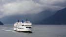
BC Ferries cancels many Christmas Day sailings, says others 'at risk'
The stormy weather in the forecast for B.C.'s South Coast is already disrupting many Christmas Day travel plans.
-
Janitors at Vancouver airport ratify deal with employer, end strike
The janitors who clean the Vancouver International Airport have ratified a new collective agreement with their employer, ending their strike on Christmas Eve.
-
Gas leaking after truck crash in Port Moody not ammonia, police say
There were tense moments for first responders in Port Moody on Christmas Eve, after a commercial truck crashed and began leaking gas.
Kelowna
-

Forfeited Hells Angels clubhouse in Kelowna, B.C., sold to the city
A former Hells Angels clubhouse that was seized by the British Columbia government in 2023 after years of fighting in court has been sold to the City of Kelowna.
-
Death of woman found in Kelowna's Waterfront Park in June deemed 'non-criminal in nature': RCMP
Police in Kelowna say a death they began investigating back in June has now been confirmed as "non-criminal in nature."
-
B.C. man sentenced for 'execution-style' murder of bystander in drug trade conflict
A B.C. man convicted of the "intentional and ruthless killing of a bystander" while acting as an enforcer in the drug trade has been sentenced for a second time in the slaying.
Lethbridge
-

'Makes them feel good': Volunteers distribute Christmas stockings at Chinook Regional Hospital
A group of volunteers at Chinook Regional Hospital (CRH) hopes to spread Christmas cheer one stocking and song at a time.
-
Motorcyclist killed in Lethbridge crash
A 36-year-old man is dead after the motorcycle he was riding collided with an SUV in Lethbridge on Monday.
-
Lethbridge police arrest 3 people suspected of impaired driving
Hundreds of drivers were stopped during the third week of Lethbridge's Check Stop campaign, an initiative that police say led to dozens of tickets and three arrests.
Sault Ste. Marie
-

Sault shopper caught with stolen credit cards
A Sault man’s illegal shopping spree came to an abrupt end over the weekend.
-
Ontario First Nation challenging selection of underground nuclear waste site in court
A First Nation in northern Ontario is challenging the selection of a nearby region as the site of a deep geological repository that will hold Canada's nuclear waste, arguing in a court filing that it should have had a say in the matter as the site falls "squarely" within its territory.
-
Sault man arrested after security guard kicked in the head over the weekend, police say
A 36-year-old Sault man was arrested Christmas Eve following an incident over the weekend.
N.L.
-

Her son needed help with addiction. Instead, he's spending Christmas in N.L. jail.
As Gwen Perry prepares for a Christmas without contact from her son, who is locked inside a notorious St. John's, N.L., jail, she wants people to understand that many inmates need help, not incarceration.
-
A massive, menacing Steller's sea eagle is dazzling birders in a Newfoundland park
A national park in Newfoundland has made the unusual move of opening in the winter so people can catch a glimpse of its rare and menacing new guest.
-
Newfoundland woman washed sick patients' hair every Saturday for more than 20 years
A retired nurse and teacher in Newfoundland was honoured this week for her volunteer work, which included more than two decades washing the hair of bedridden hospital patients.


