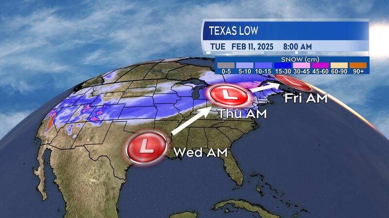
A low-pressure system moving through the United States will bring a lengthy swath of heavy snow across southern Ontario, Quebec, and into the Maritimes Wednesday into Thursday.
System timing
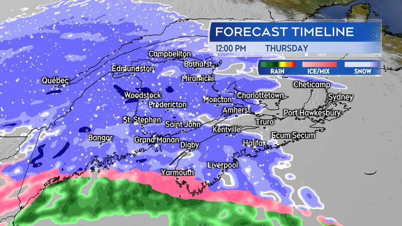
Snow will be on the doorstep of western New Brunswick and southwestern Nova Scotia early Thursday morning.
The snow will develop west-to-east across the Maritimes by early Thursday afternoon. The snow turning to a mixture of ice pellets, freezing rain, and rain for southern New Brunswick, Nova Scotia, and Prince Edward Island – remaining as snow in northern New Brunswick.
The wintry mix of weather is expected to clear Thursday evening but is trailed by scattered flurries into and through Friday.
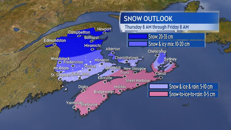
Snow amounts
The most snow is lined up for northern areas of New Brunswick. Communities such as Grand Falls, Campbellton, and Miramichi should expect 20 to 35 cm of snow. Woodstock, Fredericton, and central parts of the province will see about 10 to 20 cm of a snow and ice pellet mix. Saint John, Moncton, and southern New Brunswick can expect five to 10 cm in snow, ice pellets, and freezing rain.
Western areas of Prince Edward Island could pick up snow and ice pellet amounts of 10 to 20 cm. Eastern parts of Prince Edward Island will see between five and 10 cm in the snow and icy mix of weather.
The initial snow for most of Nova Scotia looks to total one to five centimetres before turning through ice pellets to freezing rain and rain. Given the cold surfaces present in the region, even if the overall snow totals aren’t that high, it is still likely to contribute to slippery and icy surfaces.
Rain in Nova Scotia could be as much as 5 to 15 mm. Due to melting snow and blocked drainage systems, there could be more water that pools than would typically be expected with that amount of rain.
Special weather statements have been issued for all three Maritime provinces.
A winter storm watch has been issued for northern Inverness and Victoria Counties in Cape Breton where snow totals in the higher elevations could reach 15-plus cm and stronger winds will prolong blowing and drifting snow Thursday afternoon into Thursday night.
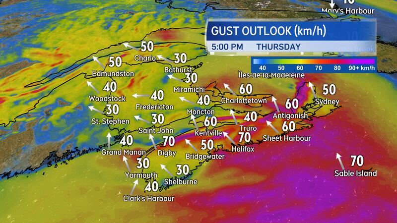
A word on the wind
A gusty southeasterly wind will accompany the wintry weather on Thursday.
For most of the Maritimes, the gusts will peak 30 to 60 km/h on Thursday. Gusts reach 50 to 70 km/h on exposed areas of the coastlines. Cape Breton will also experience more widespread gusts near 70 km/h Thursday evening and night. Due to the topography of the Highlands, northern Inverness County will experience a Les Suêtes wind with peak gusts approaching 130 km/h or more.
The wind will become northwest by Friday morning. Friday is expected to be a windy and frigid day with gusts 40 to 70 km/h. Wind chill values will make it feel well down into the minus-teens and near minus-20 by the afternoon.
Marine Atlantic is cautioning on potential disruptions to the ferry service between Nova Scotia and Newfoundland due to the inclement weather.
Another significant mix of snow and ice pellets is expected for the Maritimes on Sunday.